

Open road from Calama to San Pedro.
San Pedro de Atacama is a Chilean town and commune in El Loa Province, Antofagasta Region. It is located east of Antofagasta, some 106 km (60 mi) southeast of Calama and the Chuquicamata copper mine, overlooking the Licancabur volcano. It features a significant archeological museum, the R. P. Gustavo Le Paige Archaeological Museum, with a large collection of relics and artifacts from the region. Native ruins nearby attract increasing numbers of tourists interested in learning about pre-Columbian cultures.
The town lies at an average of 8,000 feet (2,400 m), thus visitors often experience mild altitude sickness such as dizziness, lethargy and headaches.

History
San Pedro de Atacama grew, over centuries, around an oasis in the Puna de Atacama, an arid high plateau. Its first inhabitants were the Atacameños, who developed basketworks and ceramic pottery crafts that can be now be appreciated by tourists in the several souvenir shops as typical products of San Pedro de Atacama.
It was part of Bolivia since independence from Spain until Chile claimed ownership during the War of the Pacific. During that war, the Battle of Río Grande was fought in the surroundings.

The Atacama Desert is located in the northern half of Chile between the Pacific Ocean, to the west, and the Andes Mountains, to the east. This 1,000-mile strip of desert, is the highest non-polar desert plateau in the world. (Antarctica is the driest place on earth if you are wondering)

The Atacama Desert is the driest place of the world. Some parts of the Atacama Desert have never received rain.

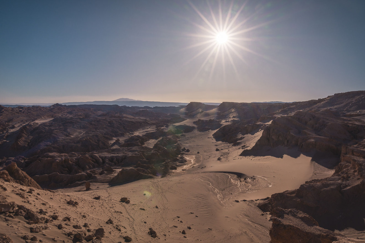
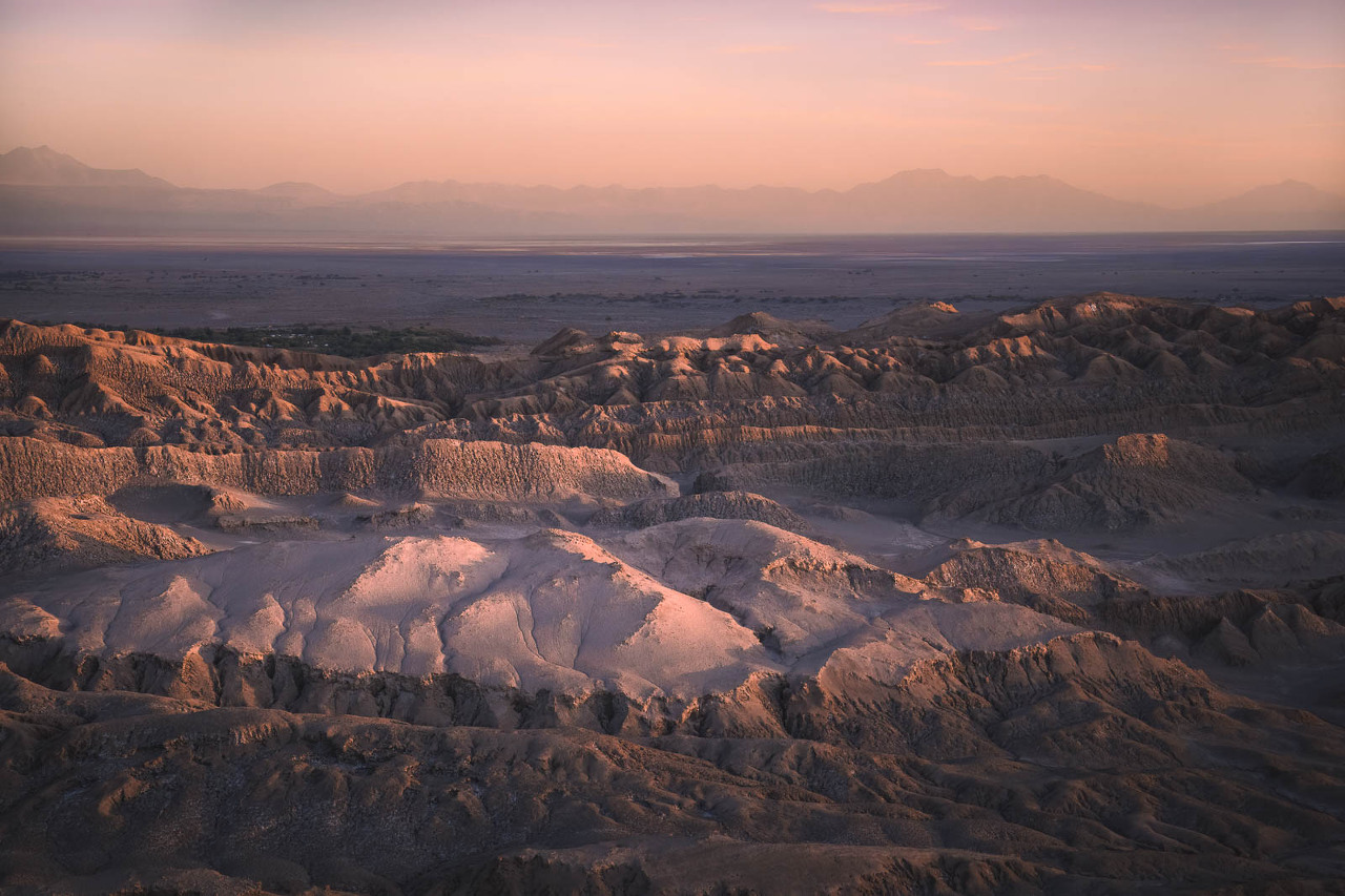
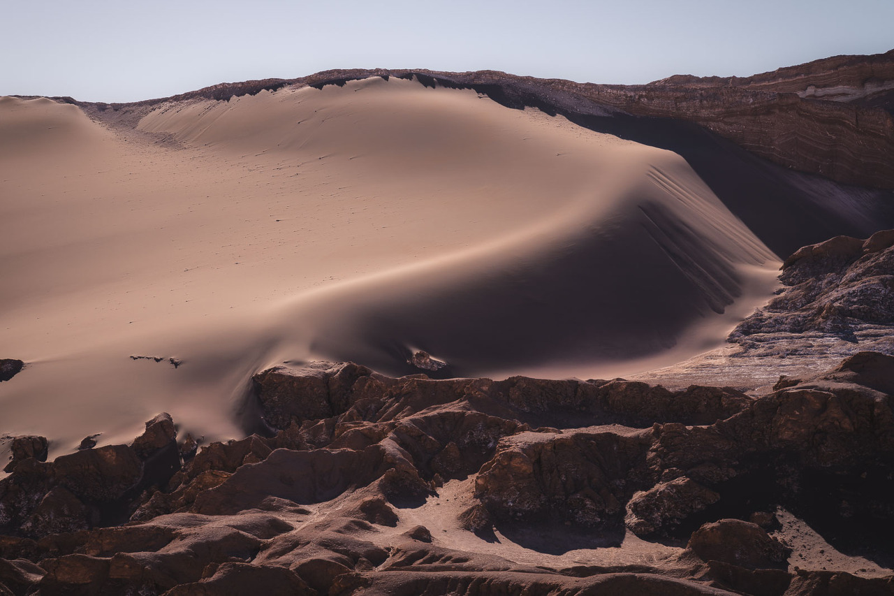
The Valle de la Luna (Moon Valley)

The Valle de la Luna is a unique landscape that is located just 13 km (8 miles) outside of San Pedro de Atacama. It is called the Moon Valley because of its similarity to the surface of the moon but it really looks more like the surface of Mars with its red rocks and red dunes.


Hike Duna Mayor
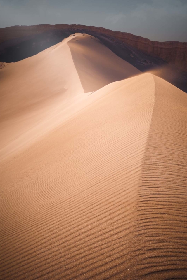
The valley is a great place for Hiking Duna Mayor , overlooking high dunes and out-of-this-world rock formations.

Mirador Lickan-Antai
There are several miradors to watch the sunset in Valle de La Luna. The extraordinary views from Mirador Lickan Antai.
Las Tres Marias Valle de La Luna

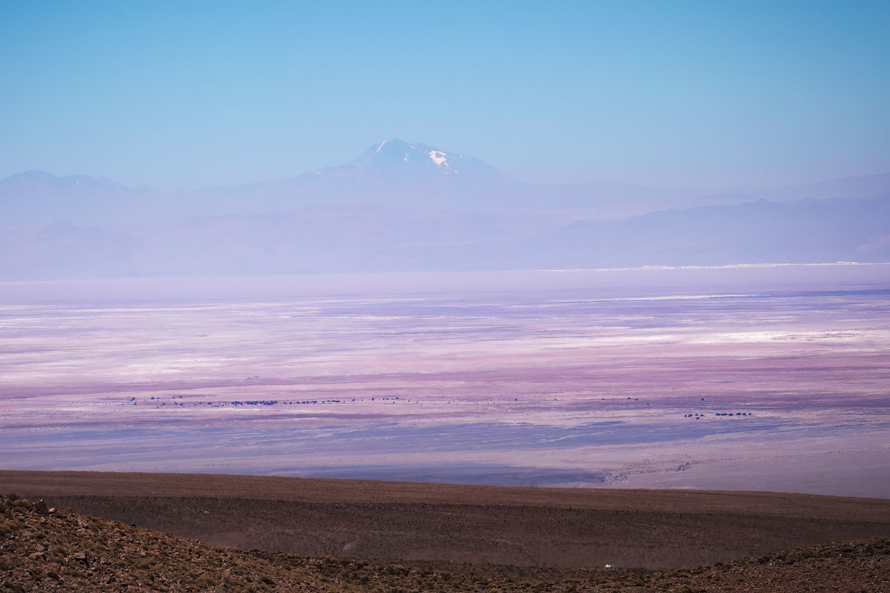
the Salar de Atacama at Las Tres Marías, the famous rock formations of the Atacama Desert. The salt flat of the Atacama Desert , a dry desert (some places only see rain every 100 years!)
Sunset from Mirador de Kari Piedra del Coyote
San Pedro de Atacama,s sunset
from Mirador de Kari Piedra del Coyote. Located outside Valle de La Luna in the Atacama Desert.
The sun creating shadows and depth on the rocky valley floor as the high mountains twinkle with color surrounding the vast desert.

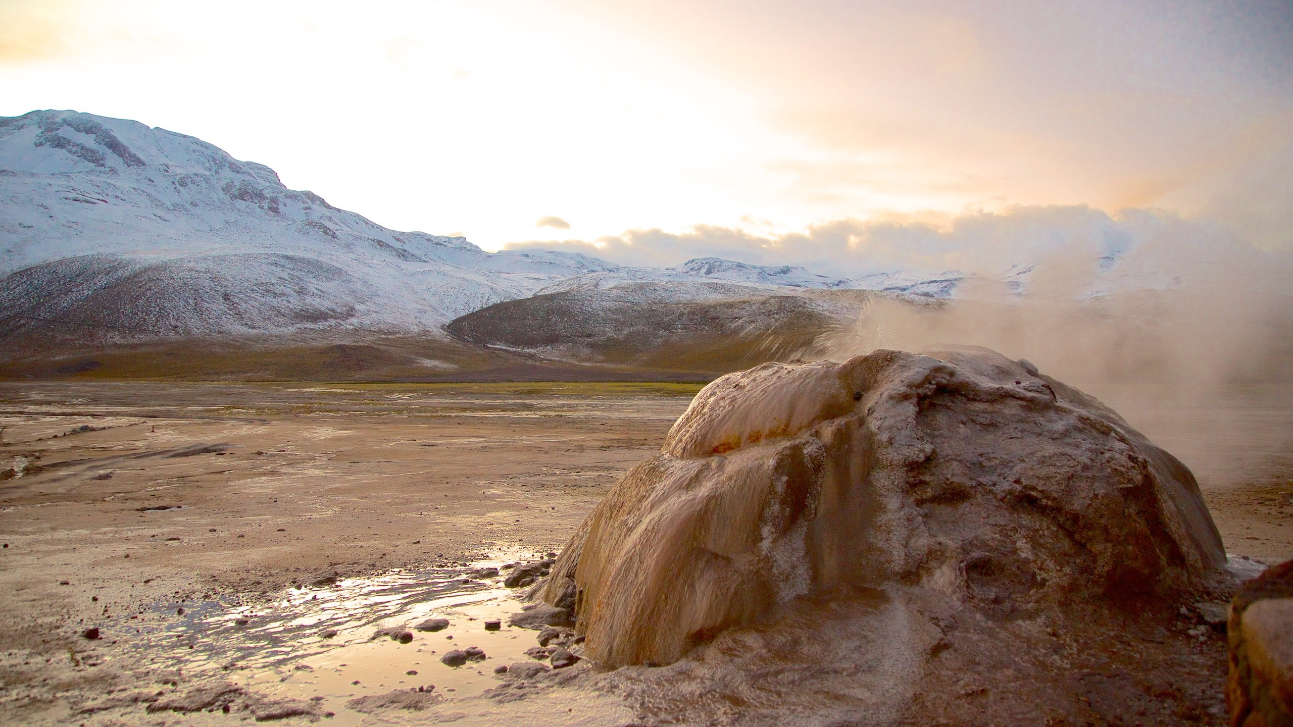
El Tatio geysers
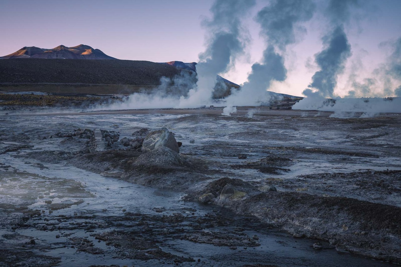
The El Tatio geysers are the highest geothermal area in the world. The El Tatio Geysers are about a two-hour drive from San Pedro de Atacama.
The geysers are most active at dawn when the water is at its hottest (and air at its coldest), and they produce steam and hot water that can reach temperatures of up to 100°C.

Geysers of Yellowstone, are the third largest geothermal areas on earth. The Grand Prismatic Spring, Yellowstone

Altiplanico Lakes 4300 metres
Lagunas Miscanti and Miñiques

The high-altitude lakes (The Lagunas Altiplanicas) of Miscanti and Miñiques,. an elevation of over 4000 meters (13,000 feet) from the picturesque lakes of Miscanti and Miniques.
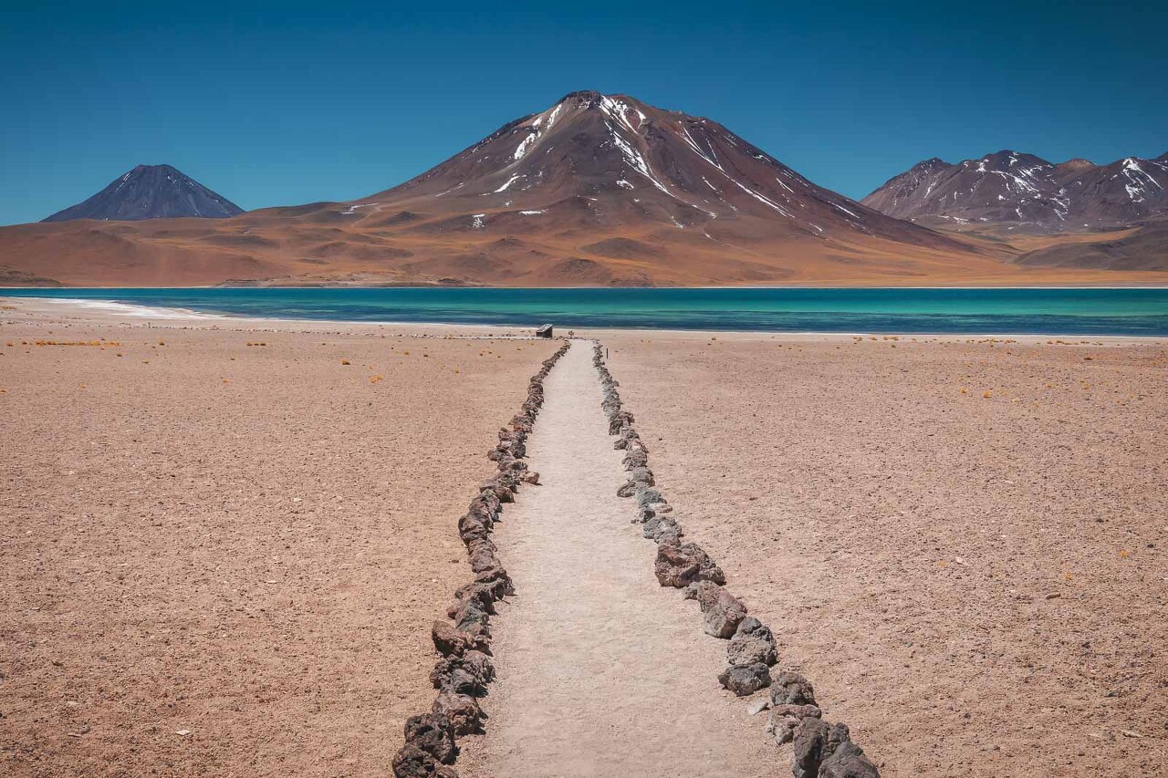
The still deep blue waters are striking and it is shocking to be standing at 4000 meters with the two high volcanoes towering overhead.
The Volcano was higher than Mount Kilimanjaro. The two volcanoes that frame the lagoons are (5,622 meters (18,445 ft)) and Cerro Miñiques (5,910 meters (19,390 ft))

Spy on Vicuñas

The lagoons are connected by a trail of rocks and you’ll be able to see wild vicunas roaming the landscape.

These animals are related to the llama and el paca families and are now protected. These vicunas are impossible to domesticate so to get their in-demand wool, they round them up to shave them only once every three years.
Stargazing
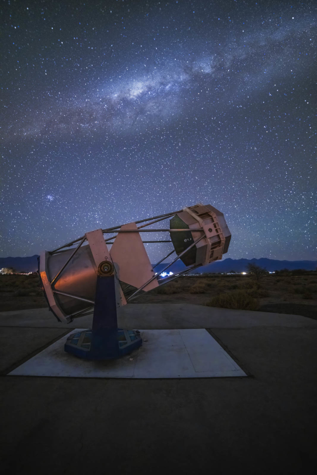
The clear, dry air of the Atacama Desert allows for excellent visibility of the stars, planets, and the Milky Way. Because of the low humidity, high altitude, and low light pollution, it is a hot spot for astronomers to study the skies, and many companies from around the world have scientists studying its dark skies.

Laguna Chaxa

As part of the Los Flamencos National Reserve, Chaxa Lagoon is the best place to see flamingoes

There are three main lagoons in Sector Soncor with the Chaxa lagoon being the best place to spot Andean and Chilean Flamingoes. The lagoons are located at a high elevation of 2300 meters (over 7500 feet)

Chile-San-Pedro-de-Atacama-Laguna-Chaxa-Flamingoes
Village of Tocanao

Besides San Pedro de Atacama, there are a few villages in the Atacama Desert.
Pueblo Machuca

Church of Socaire
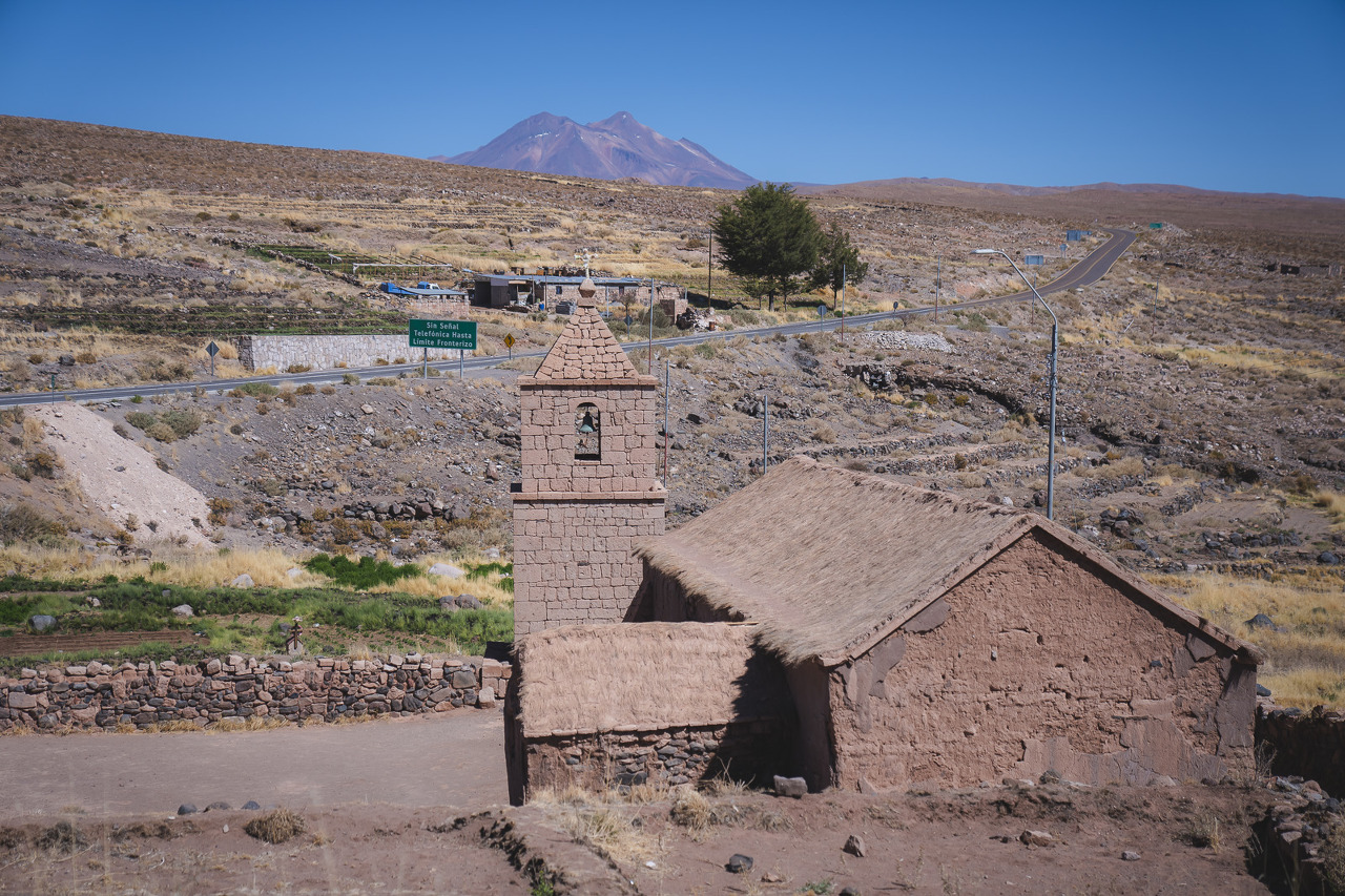
Socaire is another stop in the Atacama Desert. The main attraction in this town is the Church of Socaire. This rustic church with a thatched roof is located in a picturesque setting just off the side of the road.
Salar de Talar
The Salar de Tara is a large salt flat located within the Los Flamencos National Reserve of the Atacama Desert next to next to Piers Rojas (The Red Rocks). It is the third largest salt flat in the world, and it is home to a variety of plant and animal life.
Salar de Talar, Located at 3900 meters, Salar de Talar is 46 square km , on the way to Laguna Miscanti.
Valle de la Muerte (Death Valley or Mars Valley)
Valle de la Muerte is named so because it is one of the harshest locations on the planet. In the past those animals (and humans) who dared to cross perished in the unforgiving conditions. No plants, animals or even insects can survive in Death Valley.
Located just 2 km from San Pedro de Atacama this is a good stop to see the rocky landscape with desert dunes and strange formations giving a taste of that Mars terrain .
Rainbow Valley – Valle del Arcoiris

Throughout the Atacama Desert, the rainbow colors of the landscape are one of the most impressive sites. Valle del Arcoiris is about 90 minutes from San Pedro de Atacama . It showcases the layers of colors reminiscent to Rainbow Mountain in Peru. While there you can see the 10,000-year-old petroglyphs of Yerbas Buenas.


By air: The nearest airport to San Pedro de Atacama is the El Loa Airport, which is located in the city of Calama. From the airport, San Pedro de Atacama, is about a 45-minute drive .


San-Pedro-de-Atacama-adobe-walls

Noticias | Cómo recorrer San Pedro de Atacama
San Pedro de Atacama
Description
The Atacama area has a desert-like climate, with big differences of temperature between day and night, and summer rains which do not surpass 100 millimeters per year. The main water sources are the San Pedro and Vilama rivers. The area's chief geographic element is the Solar de Atacama, occupying a surface 100 kilometers long by 80 km. wide. The salt mine is a result of the surfacing of underground waters saturated with mineral salts which, on evaporating, leave a crust rich in salts and minerals. The rivers, fed by the Andean snows, irrigate the area allowing the configuration of numerous oasis. This is the scenario where the Atacama culture developed. The first people to inhabit the Atacama area arrived at the place by the year 10,000 B.C., at a time when the area had large lakes and mighty rivers on account of the end of the glacial era. Evidences from the first archaic hunters in the region show that they hunted wild camelidae and rodents, that they used stone artifacts and lived a nomadic life in natural eaves and caves. Later on, high concentrations of wild camelidae and the exploitation of vegetable products made possible for these people the adoption of a semi-sedentary and migrating way of life. During autumn and winter, these groups collected the fruits of the alparrobos and chadares growing in the oasis, while in early summer, they climbed up to the high plateau for hunting camalidae and picking obsidian. Culture prospered during this stage: the first tombs found are circular cavities demarcated with stones which date back to 4,000 years BC; they contained bent bodies laying on their sides, sometimes accompanied with grinding mortars. The Atacama people turned definitively sedentary during the second millennium BC, when they began growing food -particularly maize- and domesticating camelidae. The breeding of the llama was their main activity; this animal provided them with wool, meat and excrement for fuei and for fertilizing their fields. Textiles and ceramics appeared at this stage; the latter consist in cylindrical containers of red polished clay, decorated with anthropomorphic motifs. Later on, a new style of pottery resulted in a black ceramic engraved with geometrical motifs. Mining, particularly of copper, was important for providing a product of exchange with far-away regions. During this stage, power was held by some prominent Atacama men who displayed their status by means of their axes, necklaces of semi-precious stones, hats with feathers, and fine textiles. Different landmarks of daily life, such as demises, crops, the arrival of llamas caravans, the mating of cattle, etc., gave occasion to festivities during which maize or carob liquor was drank and tobacco from the northeast of Argentina was smoked in pipes. Special importance within religious life -dominated by the figure of the chaman-, had the use of hallucinating drugs, for which several sorts of tablets and tubes, richly adorned, were used. The deceased were buried in funeral bales: the bodies were shrouded with their clothing, wrapped up like a parcel. The first Atacama farmers built villages like that of Tulor. Located 10 kilometers to the southeast of San Pedro, it has circular adobe houses crowded together, with conical roofs supported by poles. The Atacama culture, developing the aforementioned features, reaches its classical phase during the first seven centuries of the Christian era. Part of this phase developed under the influx of the Tiwanaku culture, influx that lasted between the years 400 to 1200 AD. This important ceremonial center, through the direct contact establisted by caravans transporting exchange products, strongly transmitted its conception of the worid to the Atacama people, giving origin to changes in the most diverse spheres. The main symbolic figures of the Tiwanahu cult, the feline and the condor, appear on objects of social significance, as the many-colored tunics worn by prominent men, the ceremonial containers of llama bones, and the tablets for hallucinating drugs. The use of ceremonial vases and gold adornments is another symbol of status. By the year 1450, the Atacama culture passed into the dominion of the Inca empire. Thus, the cult to the sun and the high summits is enforced upon the people of the area. Ceramics registers the new political reality, and expresses itself in the typical Inca aribalos. The Inca influx improved metallurgy among the Atacama people, and also architecture. From this epoch are defensive construction like the Pukara de Quitor, and the village of Catarpe, administrative center built in stone and mud, from which the taxation on behalf of the empire was organized. In 1540, the Atacama people make contact with the Spanish conquistadores who, after defeating them in the military order, settle in the area and establish Encomiendes de Indios (land and native inhabitants granted to a conquistador), parish and civil administration. The evangelization of the Atacama people succeeded in tu rni ng Ch ristian ity into a value of their own , thus giving rise to an Andean Catholicism lasting to the present day. The Hispanic urban pattern and architecture, combining the Spanish contribution and native techniques, have also survived. The main landmark is the local church, built at the beginning of the XVIII century, after the destruction of the older one. Of a cross-like ground plan, its nave is 41 meters long by 7.50 wide. It is of stone and adobe. The roof framework is of local woods: chahar and alpanrobo, and the ceiling is made of small cactus boards, covered with mud and straw. The characteristic element of the indoors ornamentation is the reredos behind the high altar, of carved stone, displaying beautiful sacred images. The bell tower, of adobe, was recently rebuilt due to the destruction of the former ones. It is built on top of a stoutly volume attached to the building, and has an outdoors staircase. Around the town of San Pedro, there are 12 ayllus, territoriai, productive and social units, typical of the traditional organizing way of the Atacama people. On the whole, the town comprises approximately 1,700 hectares. Its inhabitants live on agriculture -alfalfa, maize and fruit trees- and on shepherding -camelidae, goats and sheep.
'Wonderful World' 카테고리의 다른 글
| San Pedro de Atacama, travel (0) | 2023.12.11 |
|---|---|
| San Pedro de Atacama , Chile (0) | 2023.12.11 |
| The Snows of Kilimanjaro (0) | 2023.12.09 |
| Travertine terraces, Pamukkale, Turkey (0) | 2023.12.09 |
| The most remote places on Earth 2 (0) | 2023.12.09 |